Vineyards Shop
Wine Map of Champagne -Black Metal Framed Poster
Couldn't load pickup availability
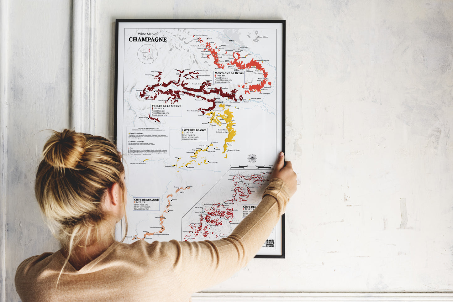
Wine Map of Champagne – Real Data Edition
Discover one of the most detailed and accurate cartographic representations of the Champagne vineyard available online. This real data–driven map breaks down the region into its five key sub-areas — Montagne de Reims, Vallée de la Marne, Côte des Blancs, Côte de Sézanne, and Côte des Bar — with vineyard surface areas and grape variety breakdowns for each.
Unlike generic maps, this one is based on official vineyard shapefiles and provides precise boundaries, village names, and the historical Grand Cru, Premier Cru villages as well as the main Clos. It’s a tool for professionals, collectors, sommeliers, and wine lovers who want a true understanding of Champagne’s terroir.
Our sleek aluminium frame with a polished finish complements the lightweight, uncoated classic matte paper—designed to last. The poster and frame ship together, requiring easy, no-expertise assembly with included hardware:
- Frame Material: Durable aluminium.
- Frame Color: Black.
- Frame Measurements: Approximately 20mm (0.8") thick and 10mm (0.4") wide.
- Paper Weight: 170 gsm (65 lb), thickness: 0.19 mm (7.5 mils).
- Paper Finishing: Matte, smooth, non-reflective surface.
- Protection: Shatterproof plexiglass protects the poster.
- Sustainable Paper: FSC-certified materials or equivalent.
- Available Sizes: 15 sizes in inches (US&CA) and cms (rest of the world).
Learn about paper types and their unique textures and finishes here.
No minimum orders, printed and shipped on demand.